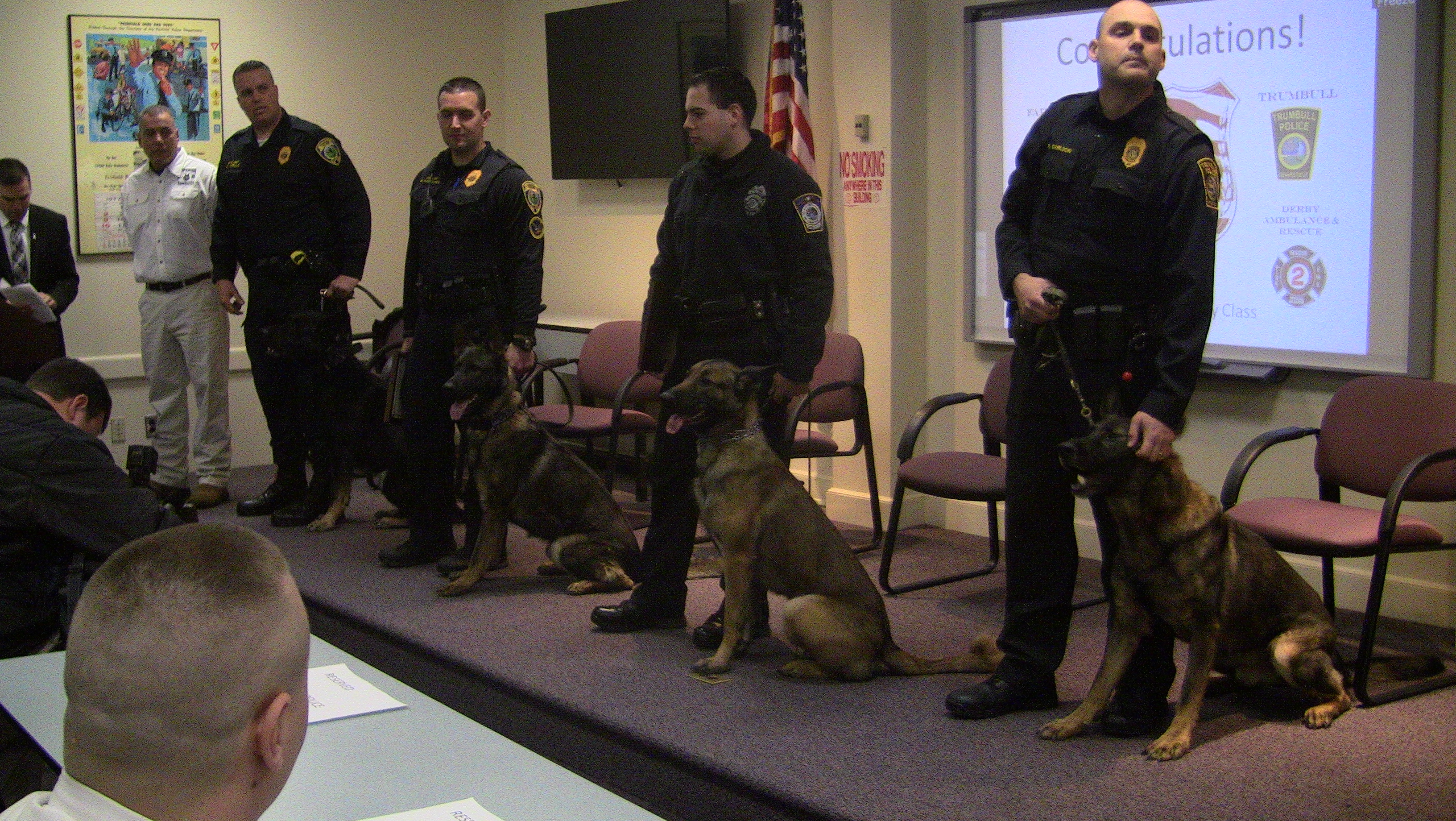
12:30am–#Shelton CT–#Huntington CT– A down tree has taken down primary electrical lines at Blueberry Lane and Vaillancourt Lane knocking power out to parts of Huntington.
This report is made possible by:
Good early Saturday morning…
These are some of the warning headlines from the NWS this morning. This will be by far the colds temps we have seen in the last 5-10 years. Heed the warnings… the only good thing is it only lasts for 36 hours and then we will see this polar air exit stage right.
Lots of model agreement and disagreement for the Early week storm. Hopefully by late tonight or early tomorrow we should have a better idea of what will happen.
Stay warm!! Tom and Kevin
Follow us on Facebook at Valley Shore Weatherdogs
Valley Shore Weatherdogs on Facebook…
11:50am–#cttraffic–#Shelton CT– First responders arriving on scene for a garbage truck that rolled over into a brook on Route 8 northbound between exits 11 and 12. There is also a hydraulic leak from a hose that broke. Possibly 30-50 gallons into the storm drains according to radio reports.
This report is made possible by:
A move North… just as we thought all along!!
As you can see we have posted a updated snow map.. It is not that far off from our first call map from the other day. We felt all along this storm was going to move back North. Does it have a chance to move south again?? Yes but we are sticking to our guns. The only real change was for the NW Hills.. you might be left out of this storm but on the other hand a slight move more to the north and you are back in the game!
This is going to be a coastal snow storm and we just dont just mean snow we are talking very gusty winds and tidal flooding too. Lets be thankful the winds will be coming from the North East and not the South East because then we would have some grave concerns for major flooding.
Time line… Snow starts along the coast Saturday morning around the 6am to 9am time frame, Hartford around 11am or so. This looks to last into the morning on Sunday.
We will post a final snow map later tonight….
Please follow us on Facebook for more up to date posts. Valley Shore Weatherdogs
This is our feeling as of this afternoon. Can this change?? Yes and it probably will. Will it go up? Or will it go down?? That is what we need to see over the next 24-36 hours. We are speaking a mere 25-50 mile shift North or South to make these numbers go up or go way down especially for those of you in Northern CT. There is a chance you see almost nothing thats how thin of a line it is. Timing as of now is Snow moves in Saturday morning and ends Sunday Morning. Again Subject to change!
The winds and coastal flooding may turn out to be a bigger issue than snow fall.
Again this is our First Call Map this is NOT our set in stone forecast! We will continue to monitor the data and post what we are seeing.
Please follow us on Facebook for more up to date information! Valley Shore Weatherdogs
Tom and Kevin
Good Wednesday morning Doing It Local fans! Sorry for our absents as of late but we have not forgotten about you! So did you hear about a potential storm on the way??? For those of you that follow us on Facebook know we are monitoring this storm very closely! So what do we know as of this morning??
The weather models currently are working their magic to give us a outcome that will satisfy everyone. Some show a moderate snow storm for us while other models say wait a minute not so fast.
Our feeling as of this morning is we will see snow here in CT. How much is yet to be determined. The time frame is still up in the air as well but we feel a early Saturday morning start and lasts into Sunday morning.
For our coastal friends we need you to heed this warning…. with the full moon in place and a large storm off the coast throwing wind at us there will be coastal flooding and beach erosion. If you live in an area that floods or if you are near an area that comes close to flooding your property the time to prepare is now. Bring what ever might be under water to higher grounds. We could easily see high tide 4-6 feet higher than normal depending on the storm track.
We are closely watching the data as it comes in. We will do our best to update on here as often as we can. For more up to date info please follow us on Facebook at Valley Shore Weatherdogs or on twitter at ctweatherdogs. Have a great day!